In the Republican River Basin, Denver Basin, and San Luis Valley, communities are working to curb their reliance on groundwater. But the road to sustainability is steep — and urgent.
To understand the predicament in the Republican River Basin of eastern Colorado, you need to appreciate the volume of water being hoisted from the underlying High Plains Aquifer, which includes the Ogallala formation.
Farmers and the few small towns in the Republican River Basin average 720,000 acre-feet of withdrawals annually. In one hot and dry year, 2012, they pumped 940,000 acre-feet. As a point of reference, Blue Mesa Reservoir, the largest water body in the state, can hold 947,435 acre-feet.
Groundwater mining cannot be sustained far into the future in many areas of the Republican River Basin. Water levels have been dropping at varying rates in different parts of the basin — from no decline to a drop of 13 feet in 10 years. Pumping at existing rates cannot be maintained. Within 25 years, about a third of land that’s now irrigated will have no water. In other places, pumps already sputter.
“Sustainable” and “pumping” do not belong in the same sentence in this basin. The water of the Republican River Basin infiltrated the High Plains aquifer as the formation was deposited some 18 to 4 million years ago. Far from the snowmelt of the Rocky Mountains, it is recharged by minimal surface water. For every six gallons of groundwater extracted, only one gallon of recharge occurs. It’s mostly an ancient bank account with now small deposits and fast-and-furious withdrawals.
The Republican River Basin and several other regions of the state rely largely on groundwater. In a 2024 decision, Colorado Supreme Court justices pointed out that it would be difficult to overstate the importance of groundwater given the state’s population and arid climate. The 285,000 wells poked into the earth across the state deliver 18% of Colorado’s water.
The Republican River Basin, the San Luis Valley, and the south-metro area of the Denver Basin are all, to varying degrees, rethinking water — both its sources and uses. All three have historically relied heavily on groundwater, and all have made at least limited progress in shifting toward more sustainable groundwater use in the last 20 years. The cities have adopted policies that foster smaller, less water-intensive lawns. They have diversified their sources. Two south-metro water utilities that 20 years ago pulled nearly all their water from wells, today have lessened that dependency to 60% to 65%.
Farmers in the Republican River Basin and San Luis Valley have somewhat different challenges. They have taken action to use less water and to save their communities, but whether those actions match the scale of the challenges they face is another matter. Changes can best be achieved before emergency sirens wail. In the Republican River Basin, some already see a swirl of red lights warning of catastrophe ahead.
Republican River Basin
The Republican River Basin consists of 7,000 square miles, an area slightly smaller than New Jersey. It is largely located within a triangle between Julesburg, Limon and Cheyenne Wells. A few businesses cater to travelers, but agriculture constitutes nearly all the basin’s economic foundation.
An average 17 inches of precipitation falls per year across the basin, less in some areas. High-dollar agriculture depends almost entirely upon water drawn from the underlying Ogallala aquifer to irrigate the basin’s 600,000 acres.
Dryland farming prevailed until high-capacity pumps and rural electrification arrived in the 1940s. Farmers in the 1950s began converting dryland areas to irrigation, dramatically expanding crop yields. Twice in the 1970s, groundwater extraction exceeded a million acre-feet per year.
Groundwater drafting via 5,000 wells today produces a bounty of herbaceous crops. Most end up in the bellies of animals. The basin has three hog farms, several dairies, an ethanol plant, and several feedlots that can each hold more than 150,000 cattle.
In 1942, Colorado, Nebraska and Kansas allocated the waters of the Republican River and its tributaries in an interstate compact. In the 1990s, Kansas complained that it was getting shorted by Nebraska. Nebraska, in turn, blamed Colorado. A 2002 settlement stipulation among the three states represented a new line in the sand. By whatever means, Colorado had to figure out how to deliver water to the downriver states.
Colorado responded by forming the Republican River Water Conservation District. In effect, the state gave farmers and others in the eight-county district responsibility for figuring out how to comply with the compact. To help achieve compliance, legislators gave the district authority to levy fees on irrigators. The fee, originally $5 per acre, has been boosted twice and is now $30 per irrigated acre annually.
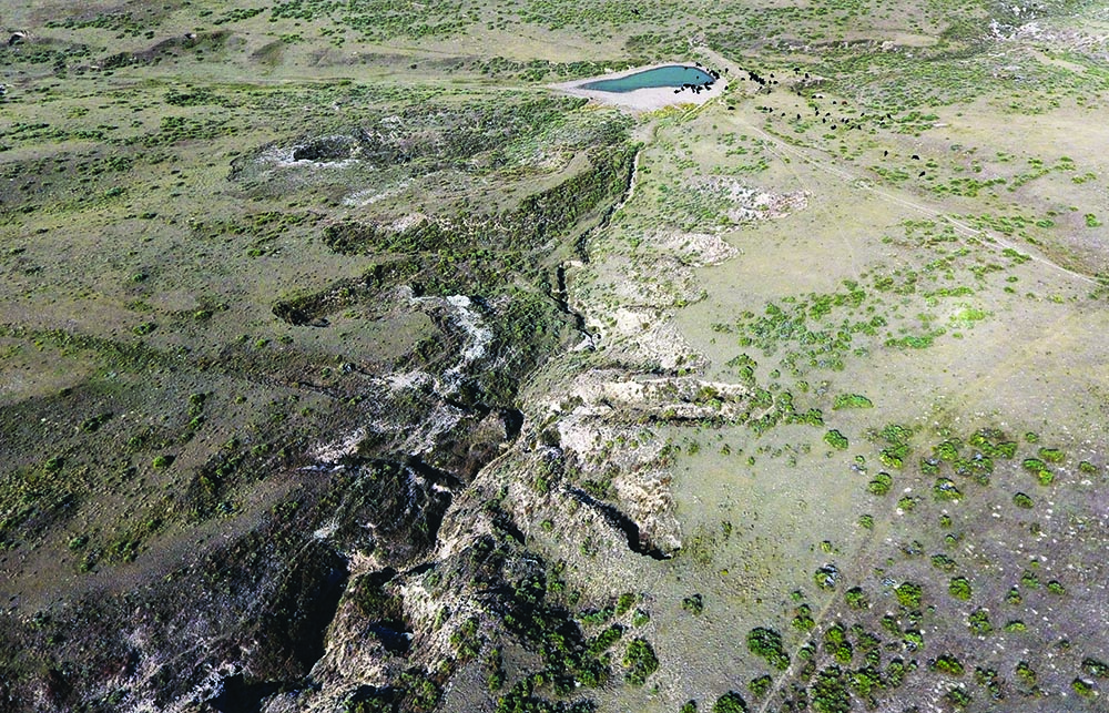
This $15 million in annual revenue is used in several ways. An early project yielded a pipeline to boost the amount of water flowing into Nebraska. Amid hills composed of sugar-like sand between Wray and Holyoke, water from eight wells, formerly used for irrigating crops in the deepest part of the aquifer, flows 12.6 miles through the pipeline and into the North Fork near where the river flows into Nebraska.
This pipeline, since its completion in 2012, has allowed Colorado to meet its compact delivery requirements. The cost of the wells, pipeline, and water rights was $72 million. Faced with declining production from these wells, the district in 2025 is planning four more wells and 9.5 miles of piping at an estimated added cost of $14 million.
In another move toward compact compliance, Bonny Reservoir, a 165,238 acre-foot impoundment on the South Fork of the Republican, was drained. Prior to the 2011 draining, Bonny had delighted boaters and anglers but lost too much water to evaporation and seepage.
More actions were needed to ensure Nebraska and Kansas received their apportioned water. Beginning in 2006, Colorado removed 30,000 to 35,000 acres from irrigation. A multi-state agreement in 2016 specified that Colorado would remove an additional 25,000 acres in the South Fork drainage by 2029.
This permanent retirement of irrigated acreage has been encouraged with financial incentives assembled from pots of local, state and federal funds. The money is delivered via two federal programs: the Conservation Reserve Enhancement Program (CREP), and the Environmental Quality Incentives Program (EQIP). The latter allows farmers to use the land for dryland farming or grazing.
By early 2025, the Republican River Water Conservation District had retired 17,120 of the 25,000 acres as required by the 2016 settlement. It was a milestone, a time for momentary celebration. The harder work lies ahead. Nearly 8,000 additional acres must be retired to meet the December 2029 deadline. If the goal is not met, the state engineer has authority to shut down wells. Nobody wants that, least of all the state engineer. To help sweeten the incentives in 2025, state legislators appropriated $6 million. This adds $750 to the $4,500 per acre paid to farmers participating in CREP and $750 to the $3,500 per acre in EQIP.
Using less water is the paramount challenge. This has been accomplished almost exclusively by taking land out of irrigation There are other ways, too. Today, corn is king, responsible for about 85% of irrigated acres in the basin. It commonly receives 20 to 22 inches of supplemental water. A growing realization of late has been that less can be more. Planting fewer seeds — say 18,000 per acre instead of 30,000 — will save money and require less fertilizer. Fewer seeds will then require only 12 to 14 inches of supplemental water, meaning less pumping, which cuts electricity bills. Lesser crop yields can counterintuitively produce better profit margins.
Conversations are also underway about water-conserving crop alternatives: milo, millet and wheat, kidney and pinto beans, even black-eyed peas. It’s partly a matter of developing markets. Deb Daniel, the general manager of the district since 2011, has been toying with how to emphasize productivity strategies with the phrase “crop per drop.”
None of this adds up to the scale of the challenge, though.
Kenny Helling, a fourth-generation farmer from the Idalia area of Yuma County, believes more is needed than financial incentives to take land out of production. “Continuing to throw money at the problem won’t fix the problem,” he says. Land must be kept in irrigation, because irrigated land pays more in property taxes. Those taxes are crucial for operating fire departments, schools and other community purposes. “It’s a very big concern to me.”
Helling was a member of the Republican River Water Conservation District Board of Directors for nine years. He says the district needs other tools. The true authority for limiting pumping belongs to the eight groundwater subdistricts within the basin. They do not use it. Why?
“Everybody on those groundwater management districts are generally irrigators,” says Helling. “Most of them are neighbors. A lot of them go to church together … Nobody wants to make anybody mad. And so, unfortunately, the groundwater management districts do not use all the authority they could to restrict the amount of water used.”
Colorado legislators, he says, need to give the Republican River Water Conservation District more authority. It needs sticks, not just carrots. “We need to use less water.”
Tim Pautler told members of the Colorado Groundwater Commission something similar in May 2025. A dryland farmer from the Stratton area, he has served on the Republican River Water Conservation District’s Board of Directors for 21 years. He says that the board has accomplished almost no basin-wide conservation. It hasn’t figured out how to substantially reduce water use. Land-owners taking advantage of the incentives mostly have been irrigators who have less groundwater available — their wells were already sputtering. He says the fees charged to farmers must be based on acre-feet of water pumped and not just on irrigated acres. Reduced water use is the goal.
There’s no pretense of sustainability in the Republican River Basin. The water deposited over millions of years is now being mined. The task is to maximize the value of the remaining water, to prolong the availability of the High Plains Aquifer. Few have yet been willing to talk about the gravity of the challenge.
“I hope enough water remains in the hole to sustain society,” says Pautler. “I hope we don’t go completely dry.”
South Metro Denver
Unlike the sparsely populated Republican River Basin, the south metro area of the Denver Basin has large and still-growing cities. Most of the south metro area lies within Douglas County, whose population ballooned between 1980 and 2025 from 25,200 to nearly 400,000.
Castle Rock, the county’s largest city, has 87,000 residents. Based on approved development, the city expects to grow to a population of 120,000 to 140,000. Parker, the second largest city, has 68,000 residents and has zoning for 80,000. Utilities serving these two cities in 2005 were almost 100% dependent upon extractions from the underlying Dawson, Denver, Arapahoe and Laramie-Fox Hills aquifers. Both cities as well as other jurisdictions have lessened their dependence, but they have much work to do.
How much water remains? That’s not an easy answer to deliver. That absence of total certainty was at the heart of a Colorado Supreme Court decision handed down in late 2024. Parker Water and Sanitation District, Castle Rock Water and others had squared off in water court beginning in 2021 with the Colorado Division of Water Resources. Park-er Water has 33 wells that are 515 to 2,745 feet deep. State-issued permits for the newest five wells state that the total withdrawals are limited to what could be withdrawn during 100 years at a rate of 1% a year. Parker Water and several other south-metro jurisdictions disputed the state’s authority to attach this stipulation.
The stipulation was premised on a 1973 law in which state legislators ordered a “slow sip” of Denver Basin aquifers. Later legislation and rulemaking clarified that withdrawals were not to exceed 1% of total recoverable water in that portion underlying the land of the permittee’s well in any given year.

Castle Rock Water relies, in part, on Denver Basin groundwater. iStock
This dispute is about the future. When those 100-year limits have been reached, will the cities be able to continue to pump groundwater after they have reached the total volumetric limits associated with their wells? Must they cease pumping even if water remains in the aquifer?
Aurora, which lies within a half-mile of Parker Water wells, argued its water rights could be harmed if Parker pumped more than the total volume of water found to be available for its wells. It is crucial to understand that water underground knows no property lines, no signs saying “Welcome to Parker.” Water could, in theory, flow from below Aurora’s land to Parker’s wells. Underground, there are no fences.
Colorado Supreme Court justices, in their November 2024 majority opinion, warned of a “race to the bottom of the aquifer, with earlier permittees receiving a significant head start.” What would happen if Parker Water, Castle Rock Water and others had their druthers?
“Absent a total volumetric limit, a permittee who continues to pump at the maximum permitted rate for more than 100 years would end up pulling water to its well that would not otherwise be underlying its land,” said the justices in their majority opinion.
In his dissent, Justice Brian Boatright came to the opposite conclusion, siding with the south-metro jurisdictions.
Some south-metro entities may seek state legislation that reflects what they believe is the best policy. As it stands now, a permit-holder that has withdrawn the total volumetric amount identified on a well permit must cease pumping, says Jason Ullmann, the state engineer and director of the Colorado Division of Water Resources. He has authority to notify users in writing of their violations. Could he shut down wells? They would be given “time as may reasonably be necessary to correct deficiencies,” he says. But yes, they would be “subject to enforcement.”
Just how much water remains in the Denver Basin aquifers? The Division of Water Resources issues well permits, and in doing so, estimates the potential volume of water underlying the applicant’s parcel. But the state agency does not track changes in volume over time, nor does it track the amount of water that wells pump. It requires well owners to maintain pumping records.
When asked how much water remains in Castle Rock’s wells, Mark Marlowe, director of the city’s water utility, suggested consultation of a hydrogeologist, perhaps from the U.S. Geological Survey. Pressed further, he said Castle Rock’s groundwater supply will last more than 300 years “from a legal standpoint” based on current rates of use.
The practical effect of the Supreme Court ruling on Castle Rock? Very little in the short term, Marlowe says. In 2005, Castle Rock set out to create a pathway to dramatically lessen groundwater dependence. “We’ve been headed down this road for a long time,” he says. So why participate in Parker’s lawsuit? Because, he replied, the city wants to make long-term use of its investment in groundwater extraction. And as a practical matter, the city commonly extracts less than the 1% allowed annually.
Marlowe’s answer is not totally satisfying, but the work done by Castle Rock since 2005 must be acknowledged. It was 100% dependent on groundwater extraction then. It is adding new impoundments to store surface water, pumping back water from Chatfield Reservoir, and doubling the daily capacity for treating wastewater. Castle Rock already has lessened its dependence on groundwater to less than 69% over the last four years and Marlowe says he’s confident that by 2050 it will lessen to 25%.
Several of Castle Rock’s successes have involved working with other south-metro jurisdictions, including the Parker Water and Sanitation District. In 2013, when Ron Redd was hired by Parker Water as general manager, the utility was still 90% groundwater reliant. He was given a mission: transition to renewable sources.
A key project has been water reuse. Water introduced into the South Platte River from other basins or from groundwater can be reused. Aurora Water set out to do so in 2003. The $680 million Prairie Waters Project pumps water from the aquifer near Fort Lupton to a reservoir in the southeast metropolitan area. From there, in 2010, Parker Water, Castle Rock and eight other south-metro communities joined Denver Water and Aurora Water in a partnership called WISE (Water Infrastructure and Supply Efficiency) to further manage infrastructure cooperatively and deliver the reclaimed water to their members.
Making this possible was a new 75,000 acre-foot impoundment called Rueter-Hess Reservoir. Completed in 2012, it is a core asset for Parker Water and three other utilities who share its use.
The Platte Valley Water Partnership is even more ambitious. Parker Water and Castle Rock Water have joined with the Lower South Platte Water Conservancy District. They plan to detain South Platte River water that currently flows downstream into Nebraska during winter and spring runoff. The South Platte River Compact allows the use of this water. There is little excess in many years, but when there is, such as in 2023, no place exists to store that water. The project will use new and existing infrastructure to capture and store those flows before pumping some of that water 125 miles to Rueter-Hess Reservoir. Farmers will also have access to a cut of this “new” water — with agricultural users receiving 50% of the captured water and municipalities receiving 50%. Construction is set to begin around 2035, at an anticipated cost of $780 million.
A final important component of the path forward for the water utilities who mine Denver Basin aquifers lies in conservation, particularly for outdoor landscaping. The prevailing theme at one time was use as much as you want — but pay for it. That thinking has shifted to goals of reduced use. Parker has reduced groundwater dependence to 60% and has goals to reduce it to 25%.
San Luis Valley
Center, as its name implies, lies at the center of the San Luis Valley. The valley is among the nation’s two most prominent places for growing potatoes. Among the growers is a fourth-generation family operation, Aspen Produce LLC.
Jake Burris married into the family. In addition to spuds, the family grows barley and alfalfa on 3,500 acres. Burris is president of the board of managers of one of six sub-districts in the San Luis Valley’s Rio Grande Water Conservation District. His subdistrict — called Subdistrict No. 1 — was formed in 2006 in response to a declining water table. What’s known as the unconfined aquifer supports this area, the most agriculturally productive in the San Luis Valley. With just seven inches of annual precipitation, irrigation in the San Luis Valley is everything. And in Subdistrict 1, much of that water comes from 3,617 wells, both active and inactive.
Alfalfa is the thirstiest crop, using 24 to 36 inches of water to get three cuttings. The strong sunshine and cooler temperatures found above elevations of 7,000 feet produce a high-quality hay that draws orders from dairies as far as California. Alfalfa is grown on 21,100 acres in the district. Potatoes cover 51,100 acres. Barley is grown on 28,000 acres. Some have replaced barley with rye. Several thousand acres have together been devoted to canola, lettuce, and other crops. A recent census found about 25,000 acres had been fallowed.

In the San Luis Valley, water from two aquifers — the confined and unconfised aquifers — irrigates crops including alfalfa, potatoes, barley and more. Photo by Allen Best
The San Luis Valley has two primary aquifers. Lower in the ground, separated by relatively impermeable beds of clay from what lies above, is the confined aquifer. The first well into the confined aquifer was bored in 1887. Because of the pressure underground, it was an artesian well. No pumping was needed to bring water to the surface. According to a 1958 report by the U.S. Geological Survey, Louis Carpenter, a professor at the Colorado Agriculture College (now Colorado State University), estimated the valley had 2,000 artesian wells when he visited in 1891.
The unconfined aquifer lies above the confined aquifer. The unconfined aquifer existed prior to major water development in the valley but water volumes rose greatly when farms began using Rio Grande water in the 1880s. Introduction of high-capacity pumps in the 1950s and center-pivot sprinklers in the 1970s accelerated groundwater extraction. In 1972, the state engineer imposed a moratorium on new wells from the confined aquifer, followed in 1981 by a moratorium on new wells in the unconfined aquifer. These moratoria acknowledge that groundwater drafting had to be limited.
Then came 2002, hot and dry, escalating the challenge. Impact to the unconfined aquifer was drastic with rising temperatures causing growing water demand even as snowpack declined.
The unconfined aquifer “has been dropping overall since about 2002,” says Craig Cotten, the Colorado Division of Water Resources engineer for Division 3, which encompasses the San Luis Valley. “We just have not had a real good series of years as far as the surface water.”
In 2004, state legislators passed a law that sets the San Luis Valley’s aquifers apart from those in the Republican and Denver basins. That law, SB04-222, explicitly orders that both the confined and unconfined aquifers be managed for sustainability. The Colorado law governing the Denver Basin aquifers requires a “slow sip” but does not imagine sustainability. In the Republican River Basin, no law speaks to sustainability. There, only the interstate compact insists upon limits.
This same 2004 law also encouraged the formation of groundwater subdistricts within the Rio Grande Water Conservation District. The thinking was that very local groups of farmers could work together to figure out how to keep their portions of the aquifers sustainable. They could also be more effective in this pursuit by working together than doing so individually.
Six subdistricts have been created in the Rio Grande Water Conservation District and one in the Trinchera Water Conservancy District. Subdistrict No. 1 began operations in 2012 after the state approved its operating plan.
All of these groundwater districts have the goal of reducing water consumption as necessary to replenish the aquifers or by introducing water into the aquifer from the Rio Grande or other sources.
Exactly how much restoration of the aquifers is needed? The state law specified a return to volumes that approximate those of 1976 to 2001 in the confined aquifer. But there’s some guesswork about how much water the confined aquifer had then. Detailed records on Subdistrict No. 1 were not kept until 1976.
In August 2024 the unconfined aquifer in Subdistrict 1 was estimated to have averaged almost 1.2 million acre-feet less water during the five preceding years than it had in 1976. The rules approved by the Colorado Supreme Court in 2011 in a document called the Plan for Water Management call for the recovery of the unconfined aquifer within 200,000 to 400,000 acre-feet of where it was in 1976. That would be deemed sustainable, as ordered by the 2004 law.
To achieve this, the state engineer said that Subdistrict No. 1 would need to recover 170,000 acre-feet each year between now and 2031. Initially, Subdistrict No. 1 aimed to take 40,000 acres out of irrigation per year, or about 80,000 acre-feet of annual groundwater pumping, to allow the unconfined aquifer to recover. That goal is unattainable, say water officials, and hence a rethink is needed. Success has occurred, though. In 2024, for example, roughly 176,000 acre-feet were pumped from the confined and unconfined aquifers in Subdistrict No. 1, the fewest since groundwater metering began in 2009. That’s about a 30% reduction.
More sustained success will be necessary. “You don’t recover that unconfined aquifer through single years of good runoff,” says Ullmann, the state engineer. “There are difficult decisions that have to be made in order to recover and restore the aquifers, but that’s what these subdistricts are trying to do.”
This success is at least partly due to efforts to modify irrigation practices and also taking land out of production. Amber Pacheco, deputy general manager of the Rio Grande Water Conservation District, explains that it’s difficult to quantify the reductions. “Some farmers, for example, have simply reduced the number of alfalfa cuttings [and hence the irrigation required], for example. Or they only irrigate when they need to do so. Others have changed the cover crops planted after a potato harvest to reduce the amount of water needed.”
As in the Republican River District, local efforts to take land out of production uses the foundation of federal programs, particularly CREP, or Conservation Reserve Enhancement Program. The subdistrict provides 20% of funds and the federal government 80%.
As did the Republican district in 2022, the Rio Grande district got an additional $30 million allocation of federal money funneled through the state. That money allows the payment of $3,000 per acre-foot of curtailed groundwater use.
More must be done to recover the aquifer. The current proposal assembled by Burris and other directors of Subdistrict No. 1 would require aquifer recharge as a condition of pumping on a one-to-one basis. Water for recharge would come from water secured from the Rio Grande or native flows into the unconfined aquifer. This new plan allows subdistrict members with surface water credits to pump from the aquifer because they are resupplying it.
The pumping allowed under the plan would be cut drastically. The Rio Grande district does not have authority to shut down wells, but it does have authority to assess fees for over-pumping. That fee is $150 per acre-foot, which the plan would elevate to $500. And, if aquifer recovery is not achieved, it would rise to $1,000.
Ultimately, the state engineer has authority to curtail wells that do not provide replacement water pursuant to an approved groundwater management plan or some other augmentation plan.
Some farmers in the subdistrict disagree with this plan. Opponents banded together as the Sustainable Water Augmentation Group, or SWAG, and filed a lawsuit to block the plan’s implementation. A five-week trial is scheduled for early 2026. Nobody expects the court’s decision to be the end of it. Whoever loses might appeal the decision, a process likely to continue into 2028.
Might the problem of the depleted unconfined aquifer be resolved by diverting more water from the Rio Grande? The river has long been over-appropriated. This year, for example, rights junior to 1880 were curtailed in May. And water must be allowed to flow downstream to comply with the Rio Grande Compact.
For the unconfined aquifer to recover quickly, Mother Nature would need to quickly step up. “It would take multiple years of above-average flows [in the Rio Grande] to recover to the level that we need,” says Pacheco. In fact, 19 of the last 20 years have been sub-average as compared to 1970 to 2000. This year’s runoff in mid-May was forecast to be 61% of the average from 1890 through 2024.
Parting Thoughts
The San Luis Valley, like the Republican River Basin, has almost no tax base other than irrigated agriculture. “Nearly everything in the valley is somehow related to agriculture. Our hospital, our schools — everything is dependent on agriculture’s existence in the valley,” says Pacheco from her office in Alamosa. From her office in Wray, Daniel has a parallel observation.
What then constitutes sustainability of the water that is foundational to agriculture or, in the case of south metro communities, their economic vitality? What decisions should be made now to foster that vitality through the 21st century?
Thoughts about conservation have shifted over time. When Colorado’s gold and silver miners arrived, they had no goal of conserving. They mined the veins to exhaustion or it became too costly to continue. In a sense, that has happened in the Republican River Basin. The only limits to this groundwater mining are those triggered by the interstate compact. Because the water in the Republican River and its tributaries is from the Ogallala aquifer, pumping must be limited — or supplemented.
In the last 20 years, the Republican River Water Conservation District has done some of both. It has or soon will have committed $80 million to pump water from wells expressly to deliver water to the Nebraska state line. One of the directors, Tim Pautler, has called this a strategy of kicking the can down the road. Other directors have started to agree.
“It’s like the clock is ticking when it comes to sustainability,” said Rod Lenz, the board chair, at the board’s quarterly meeting in May 2025. “What more can we do with the tools we have? Do we dare ask for more tools such [as would be delivered by] statute changes? Do we really want all the groundwater districts in the basin to ask the state engineer to reconsider how much we’re allowed to pump, or do we just stay in compliance until we can’t?”
In the San Luis Valley, coming off the century-defining drought of 2002, state legislators went in exactly the opposite direction. They said that the unconfined aquifer was to be managed sustainably. Granted, that’s easier said if you have a major river flowing nearby, even if that river has been hammered hard by the warming, drying climate of the 21st century.
The south metro area falls somewhere between these extremes. State legislators nearly a half-century ago ordered a “slow sip” of the groundwater to preserve it for a century. In some places, there seems to be sufficient water to slow sip for another 300 years. In other places, the aquifer might have enough water for a few decades. Some water utilities hope for a completely sustainable water supply in decades ahead. Much work has been done. The harder work lies yet ahead.
We need aspirations premised not on entitlement and enrichments solely for today, but instead to build economies and cultures that more comprehensively look several generations ahead. That should be the question in all of these meetings, all of these court cases, all of these individ-ual actions. Based on what we know and understand today, what should we be doing for the kids, grandkids and their grandkids, too? Are we doing better than kicking the can down the road?
Allen Best is a frequent contributor to Headwaters magazine. He publishes Big Pivots, an e-journal that chronicles the energy and water transitions in Colorado and beyond.
 Print
Print